OKLAHOMA CITY (KFOR) — Monday will be humid and warm with highs in the upper 70s.
An isolated storm is possible and could be strong to severe.
Our best storm chance will be this evening across western Oklahoma. Southwestern Oklahoma will have the highest threat of severe weather with up to baseball size hail, 80 mph winds and an isolated tornado.
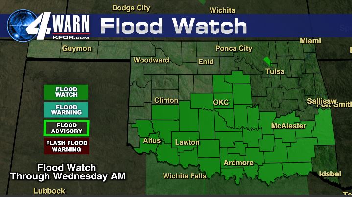
Storms will move east overnight across central and southern Oklahoma with a wind, hail and flooding threat.
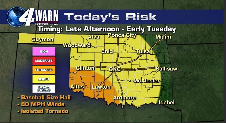
Scattered storms develop tomorrow with another round of severe weather. Exact severe storm location is difficult to pinpoint as storms will form on left over boundaries from the night and morning before.
Storm chances remain through early next week with areas of flooding and severe weather possible. Stay tuned for the latest!