This is an archived article and the information in the article may be outdated. Please look at the time stamp on the story to see when it was last updated.

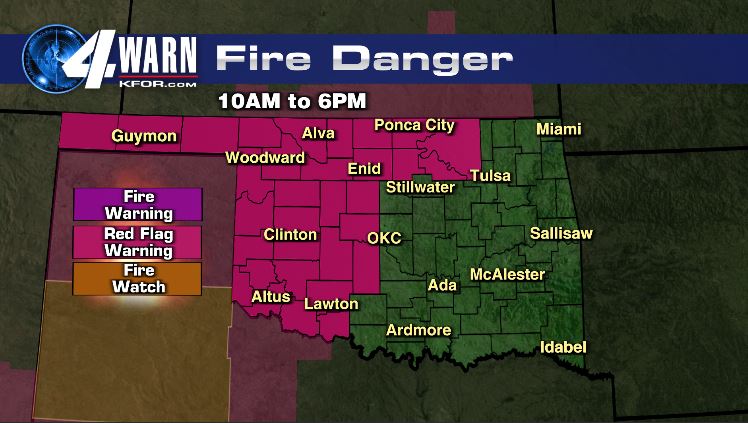
A cold front will sweep across the state this evening and strong north winds and cooler air will follow. Any wildfires that are ongoing will shift direction with the front. Be careful this evening!
Wind chills will drop to the teens and 20s early Saturday. Saturday will be much cooler with highs only in the upper 40s. Temperatures rebound with record highs possible (again!) Tuesday and Wednesday. A storm system could bring rain by the end of next week.